Published in Platform 12: How About Now? (Harvard University Graduate School of Design and Actar, 2019)
Airport Archipelago presents an alternate future for decommissioned industrial sites, one that challenges the prevailing instincts of urban development and instead offers integrated and innovative economic, infrastructural, ecological, and recreational systems that respond to the uncertainties of environmental change and provide greater direct benefits to surrounding communities. The project’s case study is Logan International Airport. Positioned between Boston Harbor and the neighborhood of East Boston, the airport’s development over the past century has depended upon landfill operations that have allowed it to extend into the harbor. Although much of the site was built to withstand tidal flooding, and thus projected sea-level rise of the next one hundred years, climate change will bring major storm events that will cease operations regularly and more extreme temperatures that will make spatial demands on the airport it cannot accommodate. The airport’s position near the city center also places restrictions on urban density due to restrictions on building heights along flight paths.
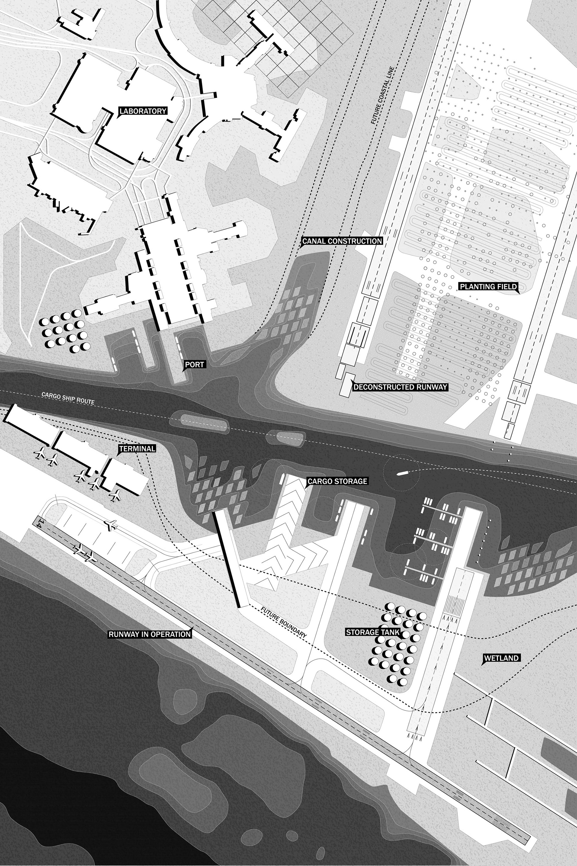
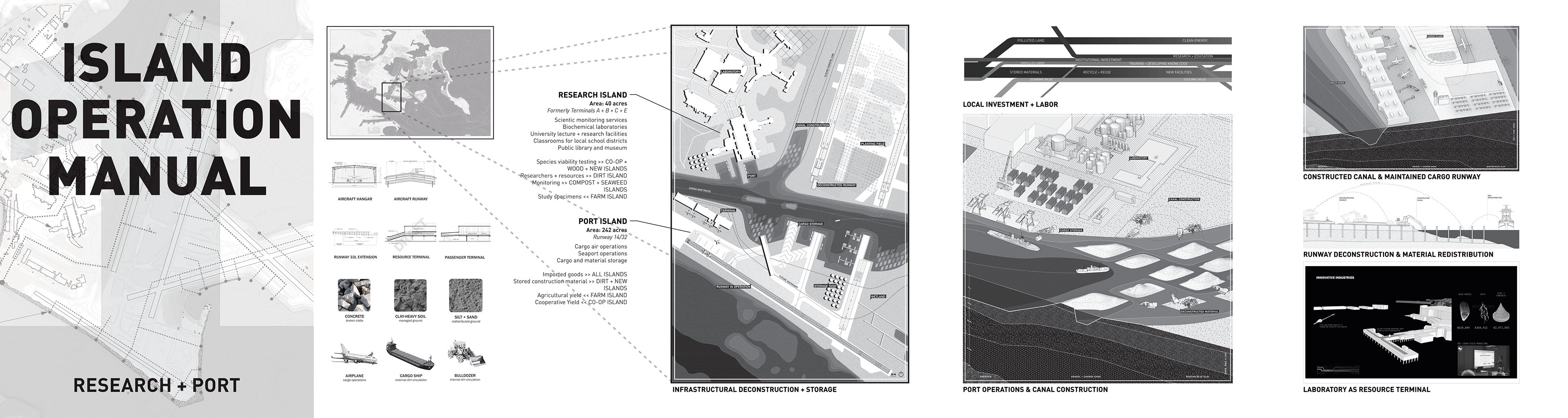
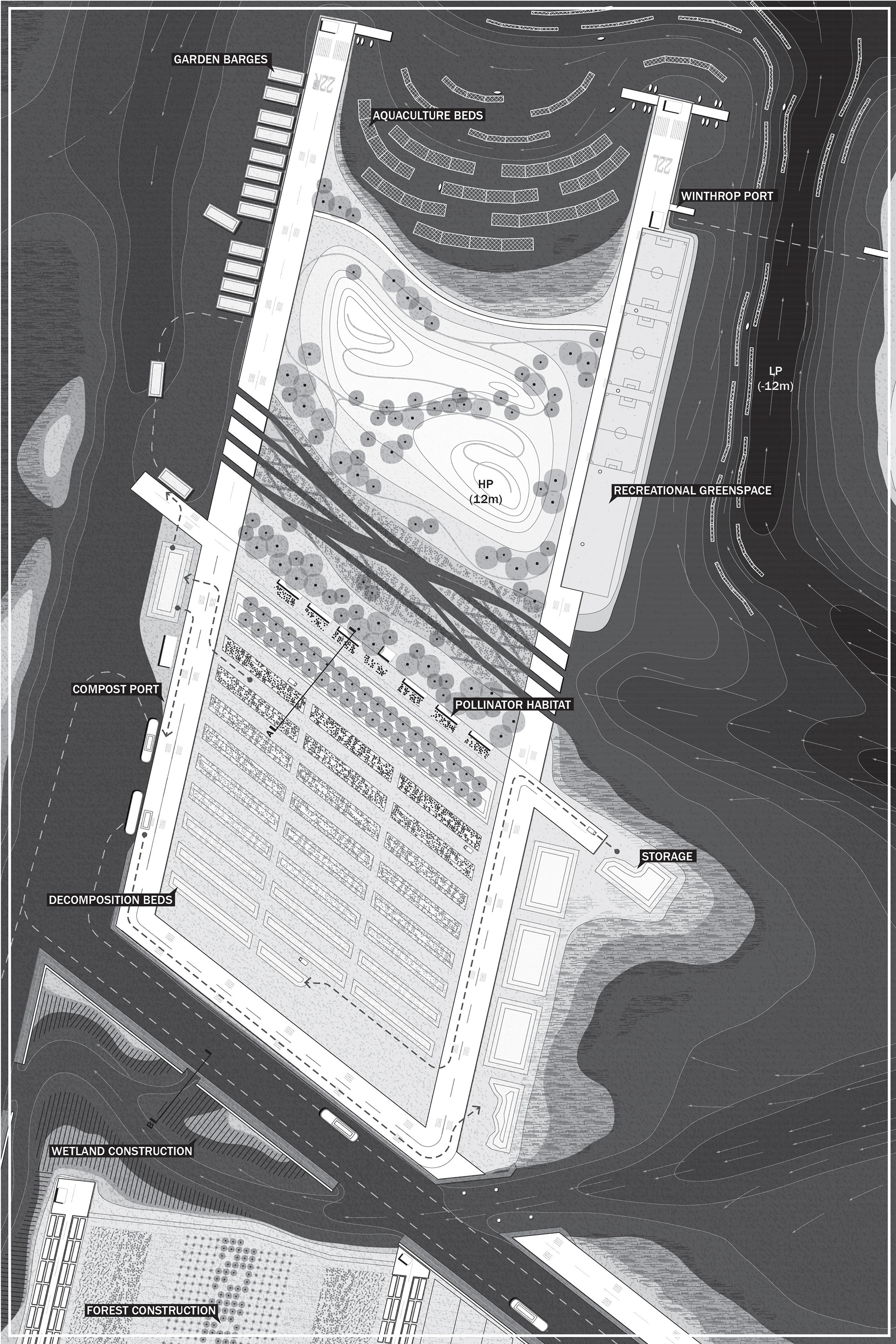
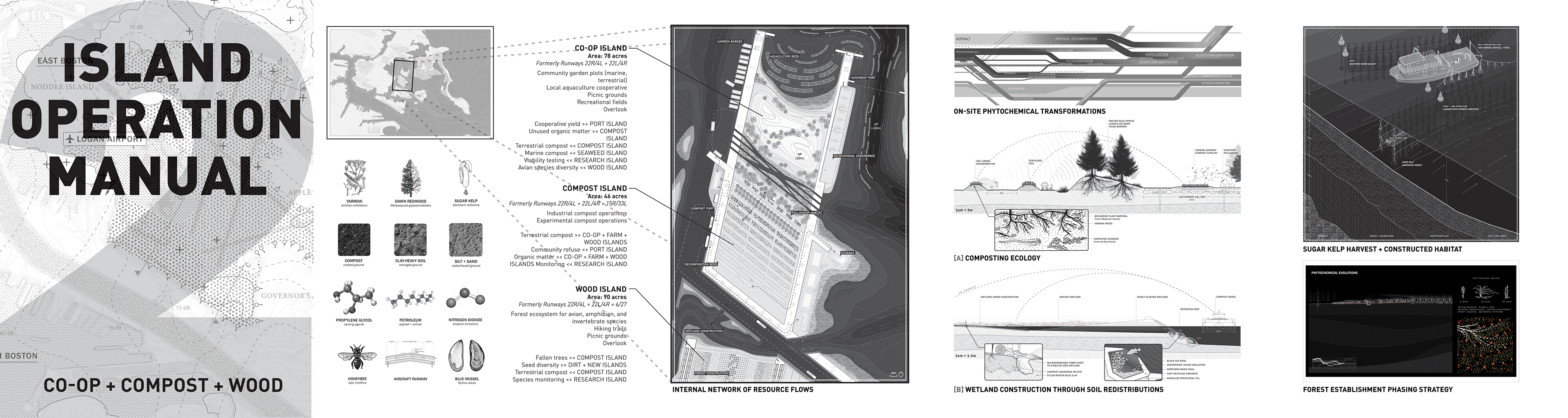
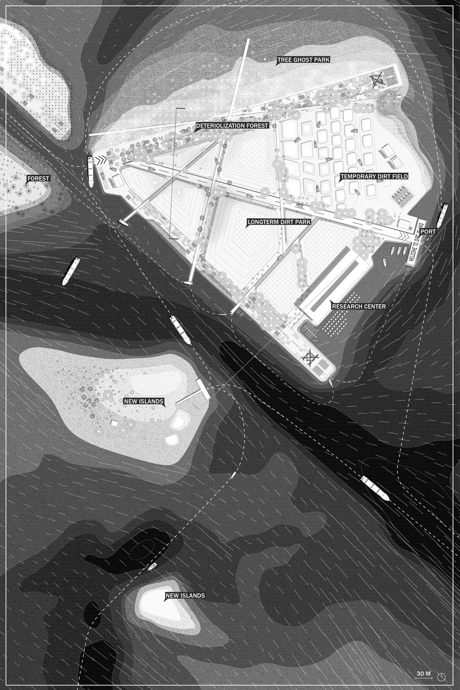
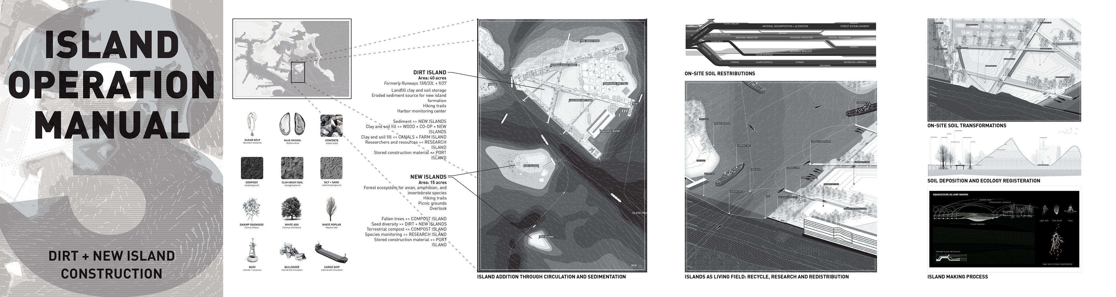
The project thus begins with the decommissioning of Logan Airport, developing an agenda for the site’s reuse. Despite its flood resilience, the site’s size and position allowed it to accept water to help mitigate damage to nearby residential communities. The design encourages flooding through a series of canals that define new islands of operation and material flows. These operations (cargo, compost, co-op, agriculture, aquaculture, forestry, excavation, storage, research, and ultimately island building through sediment deposition and material reuse) were designed with the goal of supporting a closed, sustainable economic and ecological loop, considering brownfield conditions and existing economic structures while also allowing for and expecting adaptation over time. By using earth, water, and plant material as the primary mediums for these operations, the project presents a new urban-industrial-pastoral aesthetic that might be appreciated not only for its contribution to the local economy and ecology but also for its sublime qualities in a recreational setting.
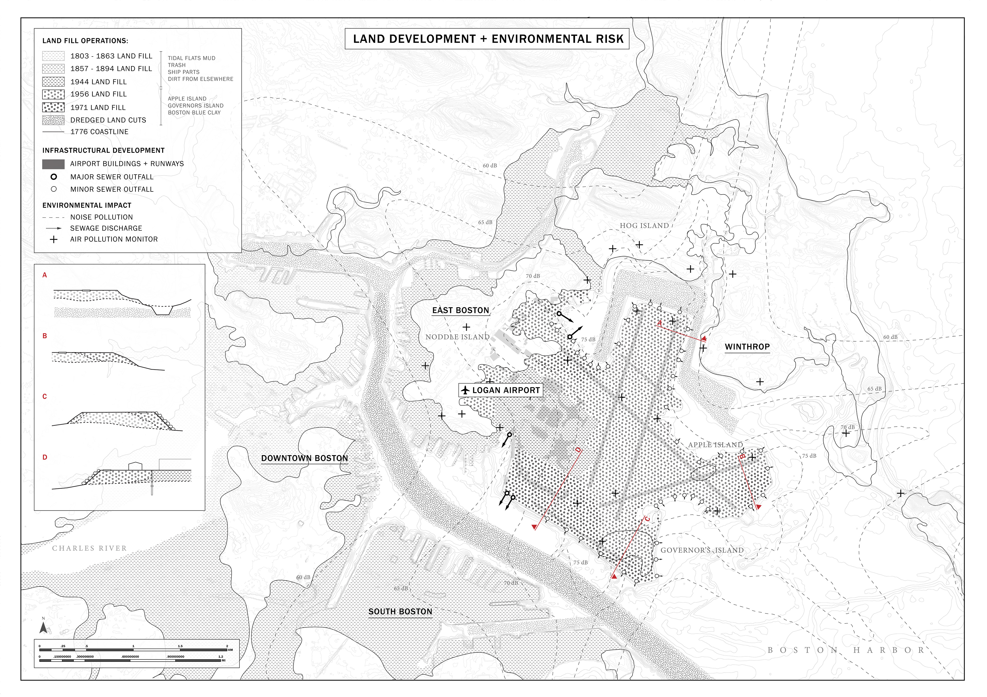
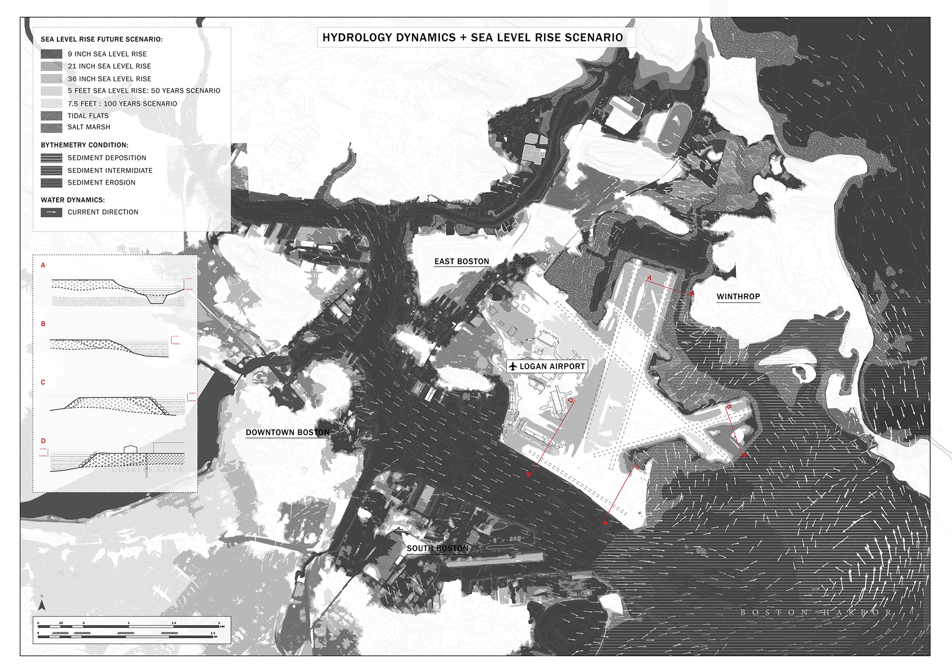
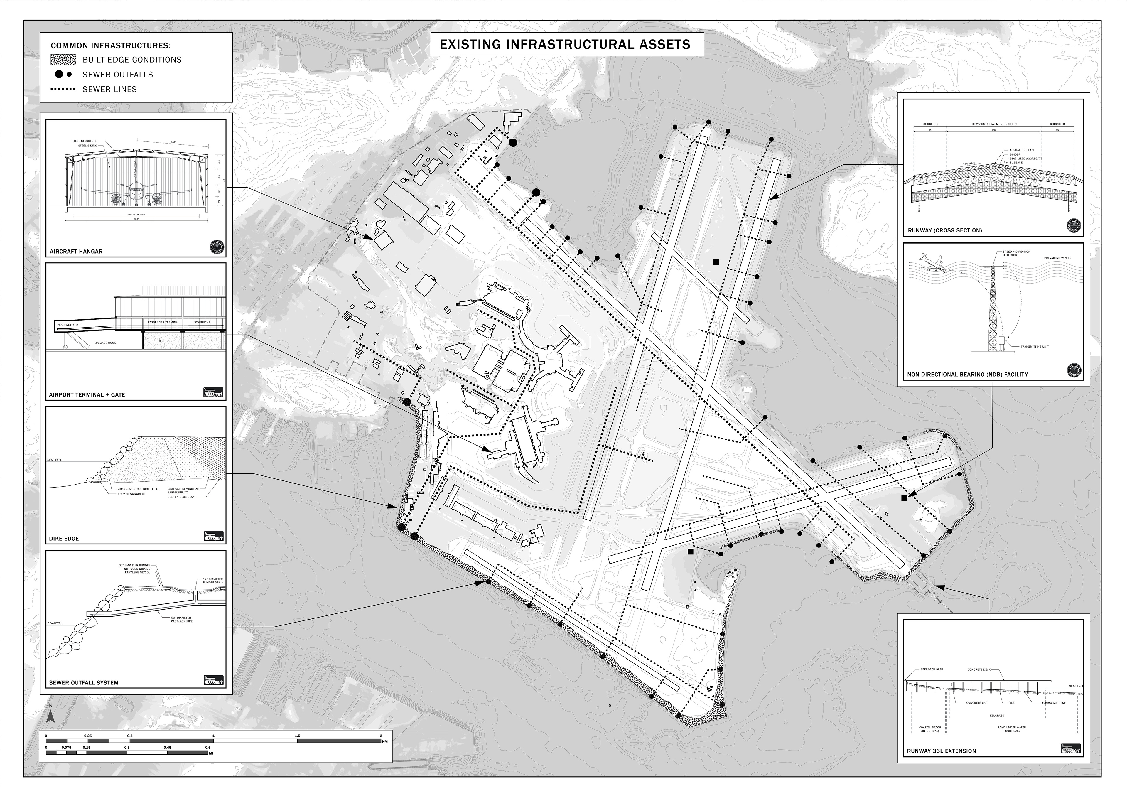
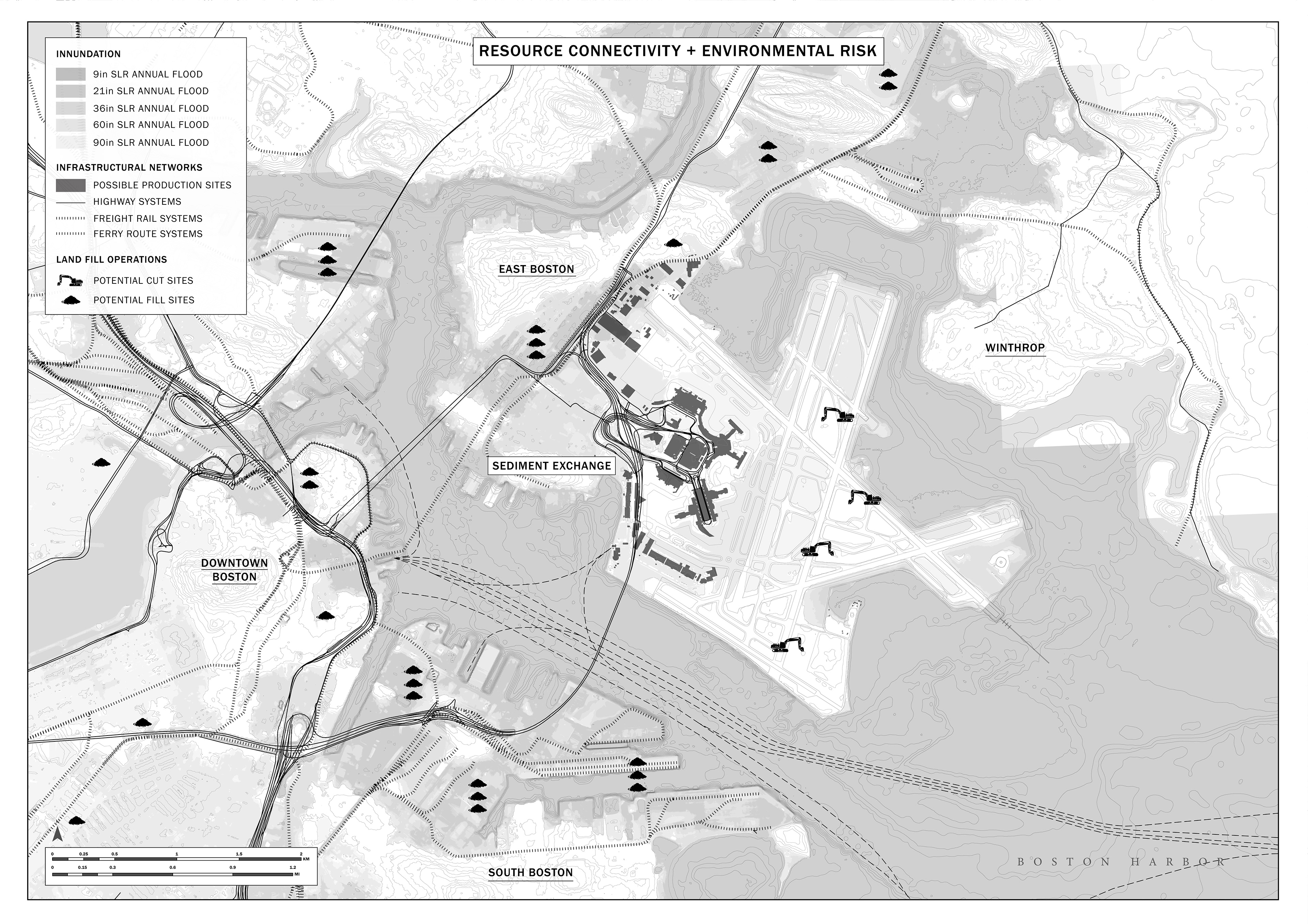
An atlas was created to investigate historical land management practices, existing infrastructure and urban context, and future possibilities and precarities
The project proposes the creation of a new state agency to manage the wealth of new infrastructure projects that will be necessitated by climate change, beginning with the relocation of Boston's international airport and the site's redevelopment. To help emphasize the importance of such governance shifts, the final design was presented through the lens of this new agency, including ersatz government reports and promotional videos.

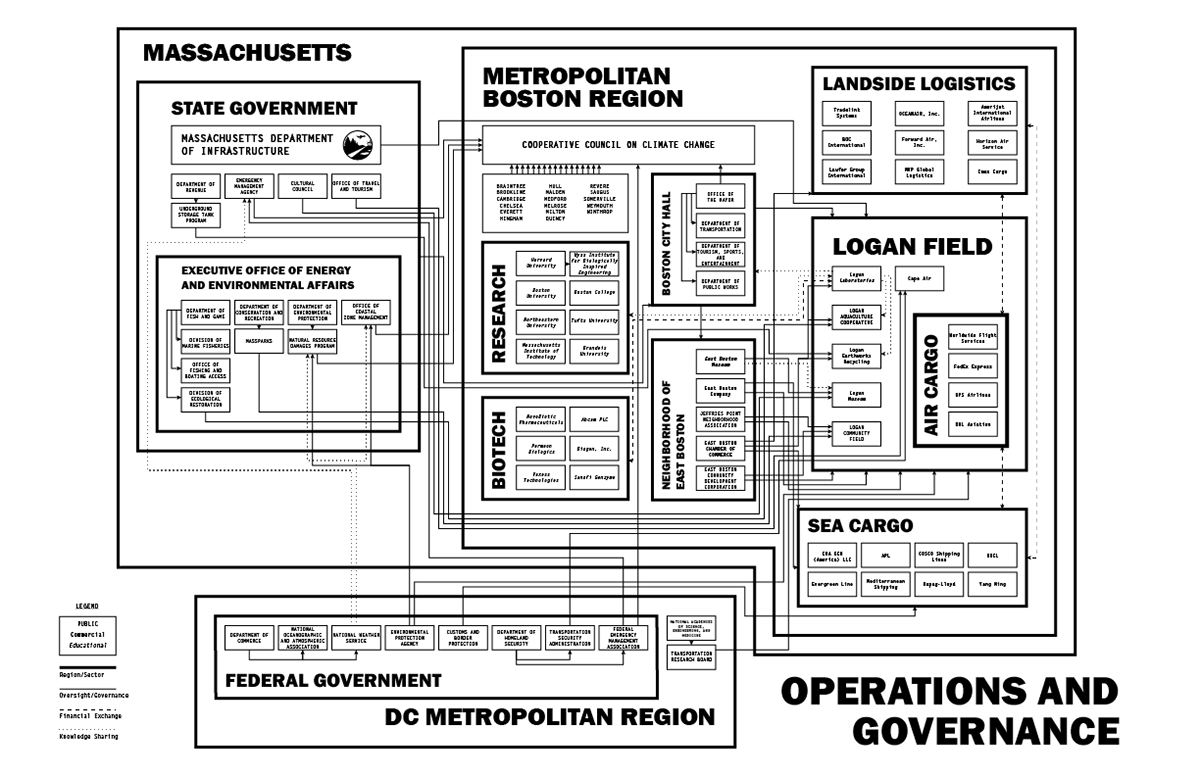
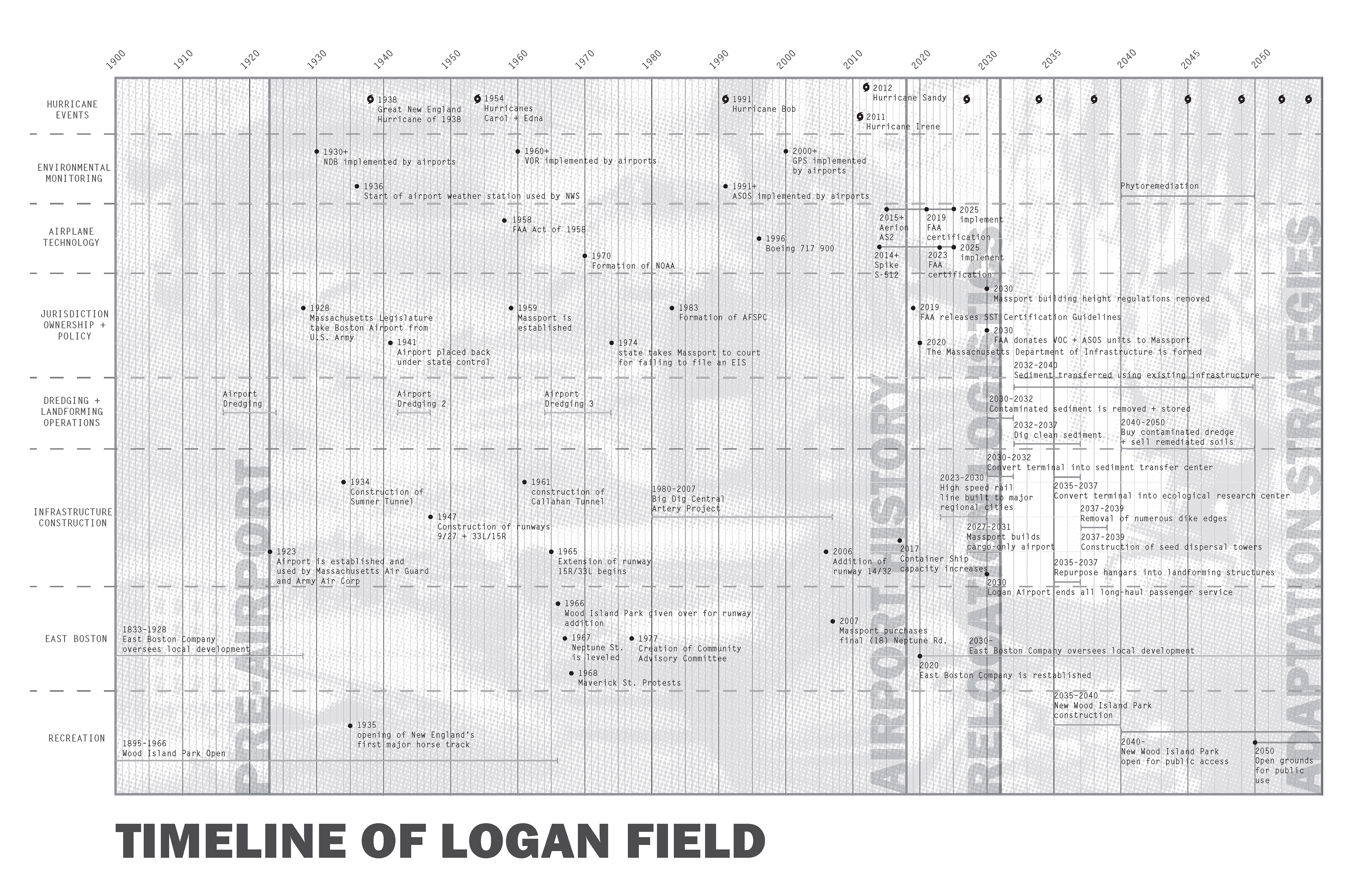
The new governance structure as well as the decades long phasing was presented through stakeholder diagrams and timelines
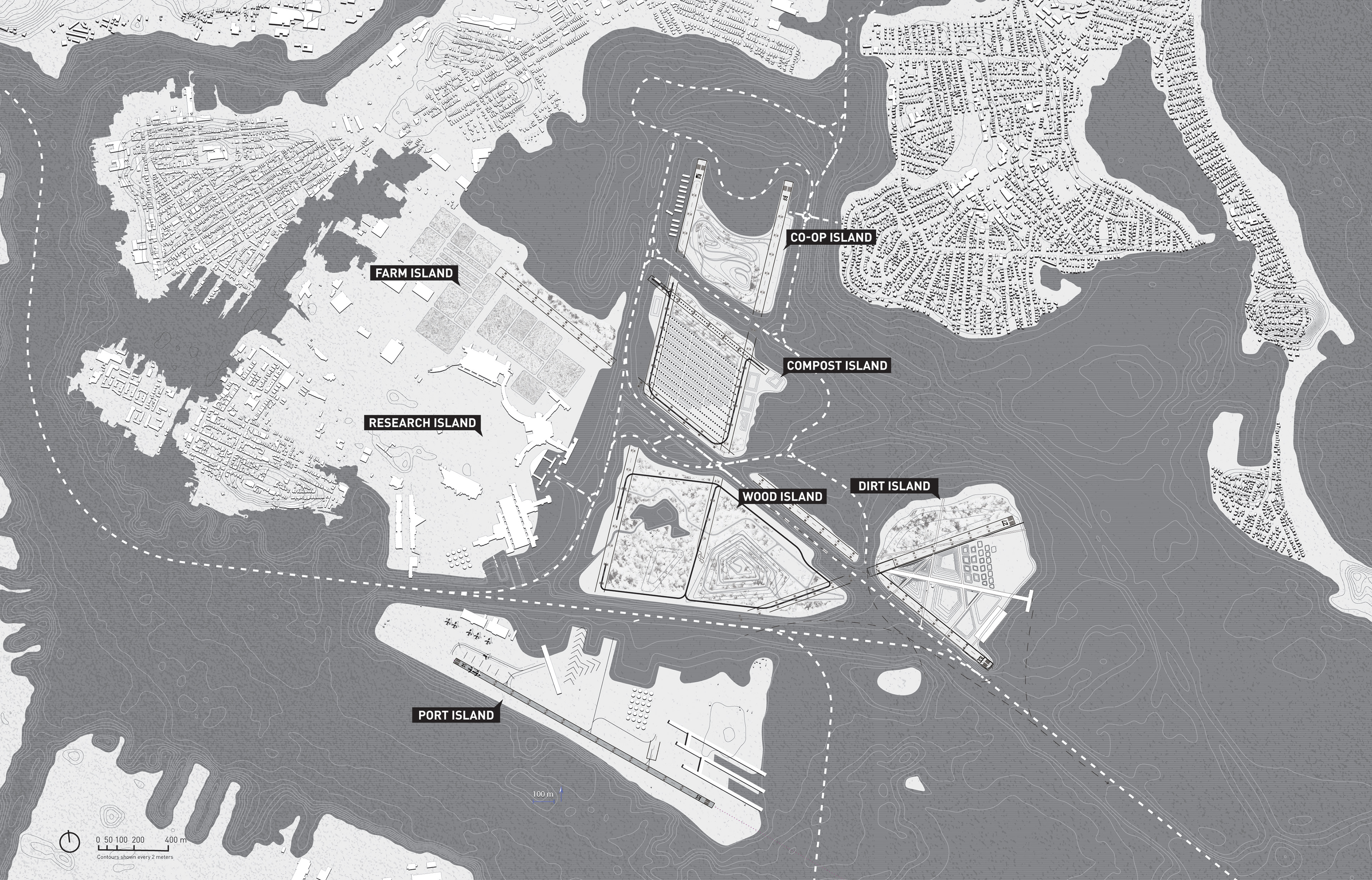
The final site plan presented the project as a series of productive islands, created over time through passive (sea level rise) and active (channelization) means, within a logistical network that connects to the greater Atlantic shipping network. Each island presents a novel economy that contributes to the project's closed metabolic loop and produces a distinct landscape that additionally offers recreational opportunities.
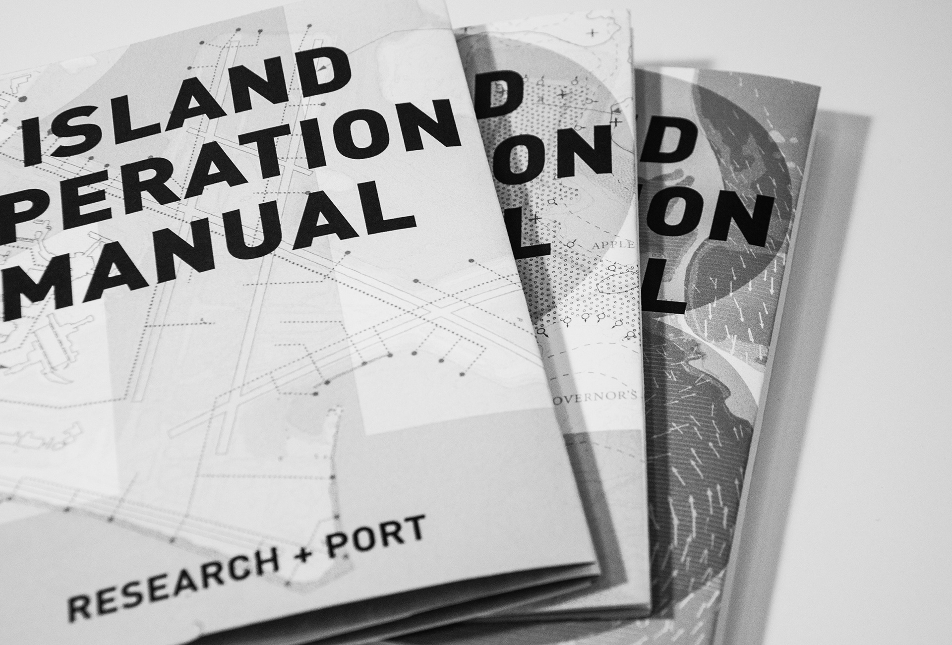
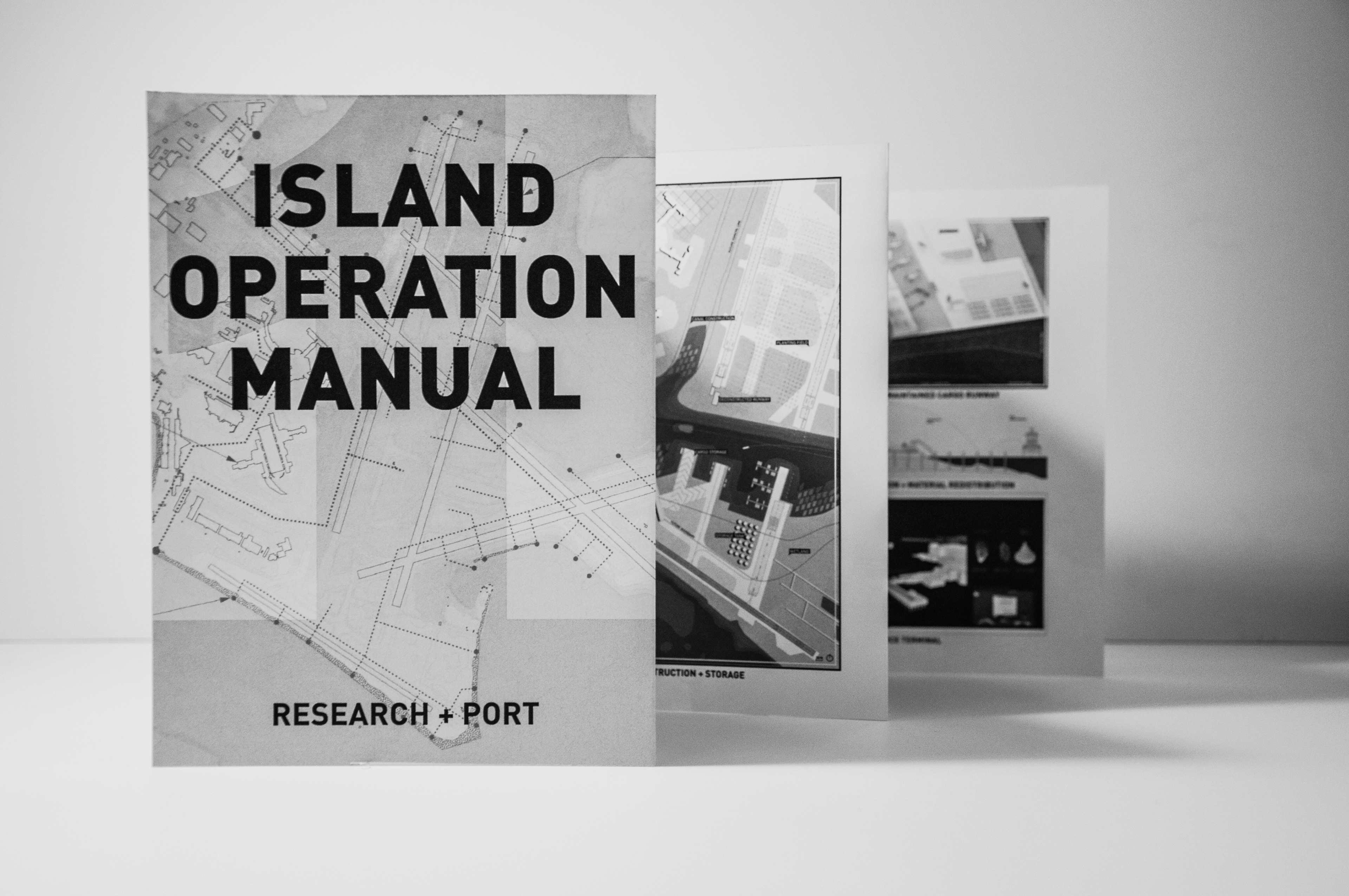
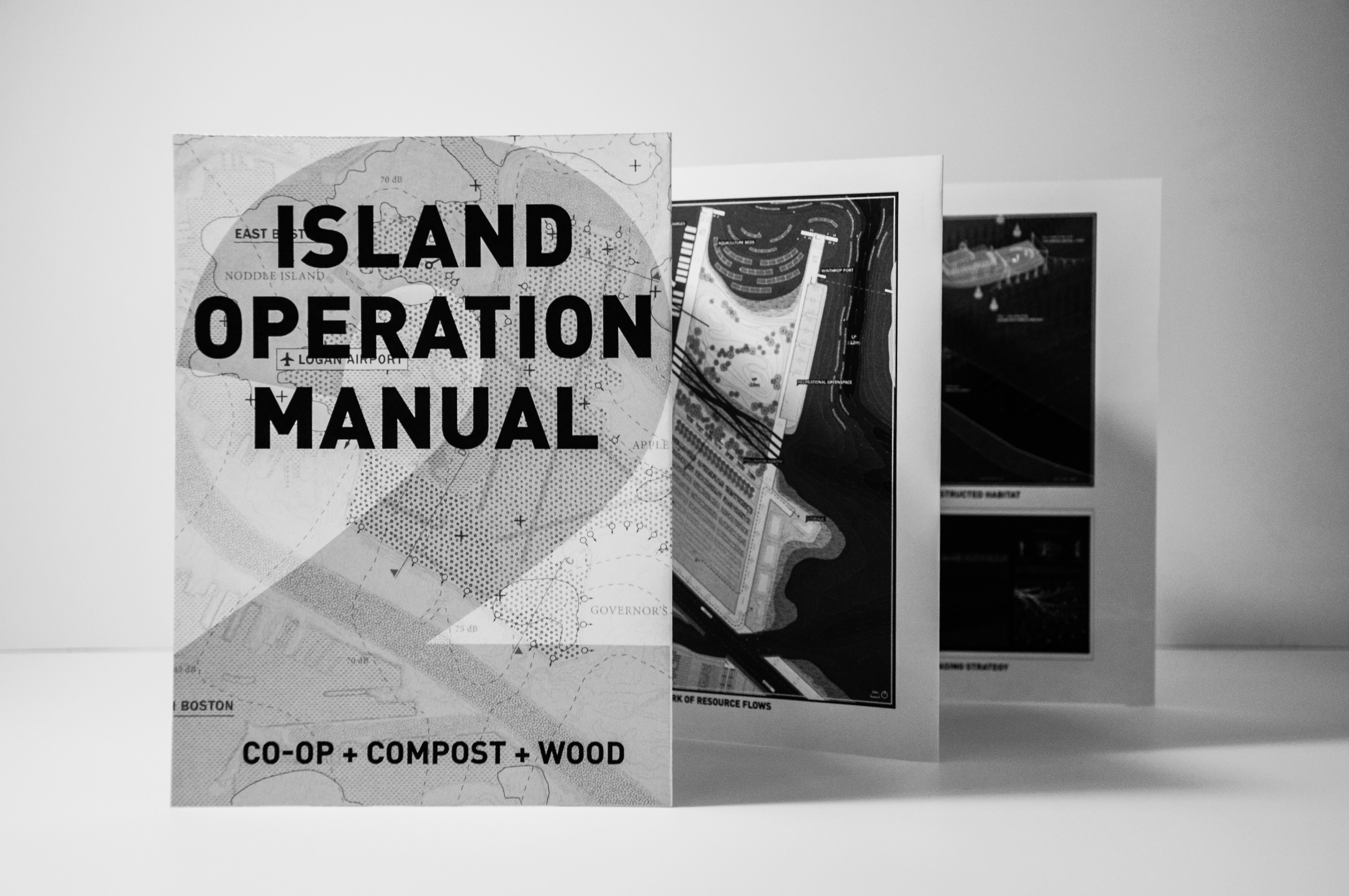
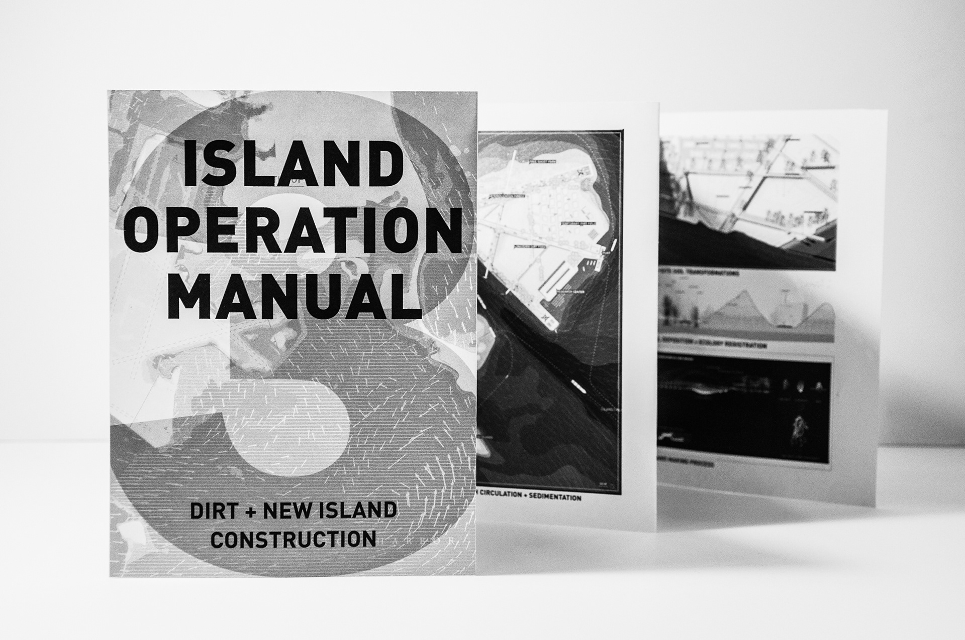
The final design drawings were presented in a sampling of field manuals that translated the project's interventions as guidelines for redeveloping the former airport site as a new, sustainable economic engine for the region.


Postcard views of the new island landscapes reveal the juxtapositions between industry and recreation