Central Park has since its inception been a sanctum of respite from the city's cacophony and density; an antithesis as Olmsted intended to the surrounding concrete jungle. Before Olmsted however, before European settlers even, Central Park and the rest of Manhattan was still a scenic landscape albeit a more wild one - Manahatta. We looked backward in time to the pre-colonial site ecologies* to inspire a park design that is didactic and interactive in regards to climate change and the environment. Formerly existing plant communities are reintroduced with southern-sourced plant materials to be adaptive to a warming future climate. The park, while still usable for recreation and meditation has had the balance between these two uses shifted. Human artifacts are now novel finds, such as a basketball court in a forest clearing or a monument lost to a marsh or grassland. The vegetation of the park is now dominant, and Olmsted's picturesque has evolved into a wild aesthetic. Primary circulation no longer engages the perimeter of the park, and now instead draws visitors into the park through various ecological zones, while bypassing others. The secondary circulatory system - the aerial path - allows a visitor to explore other zones with reduced disturbance, while providing a rarely experienced perspective.
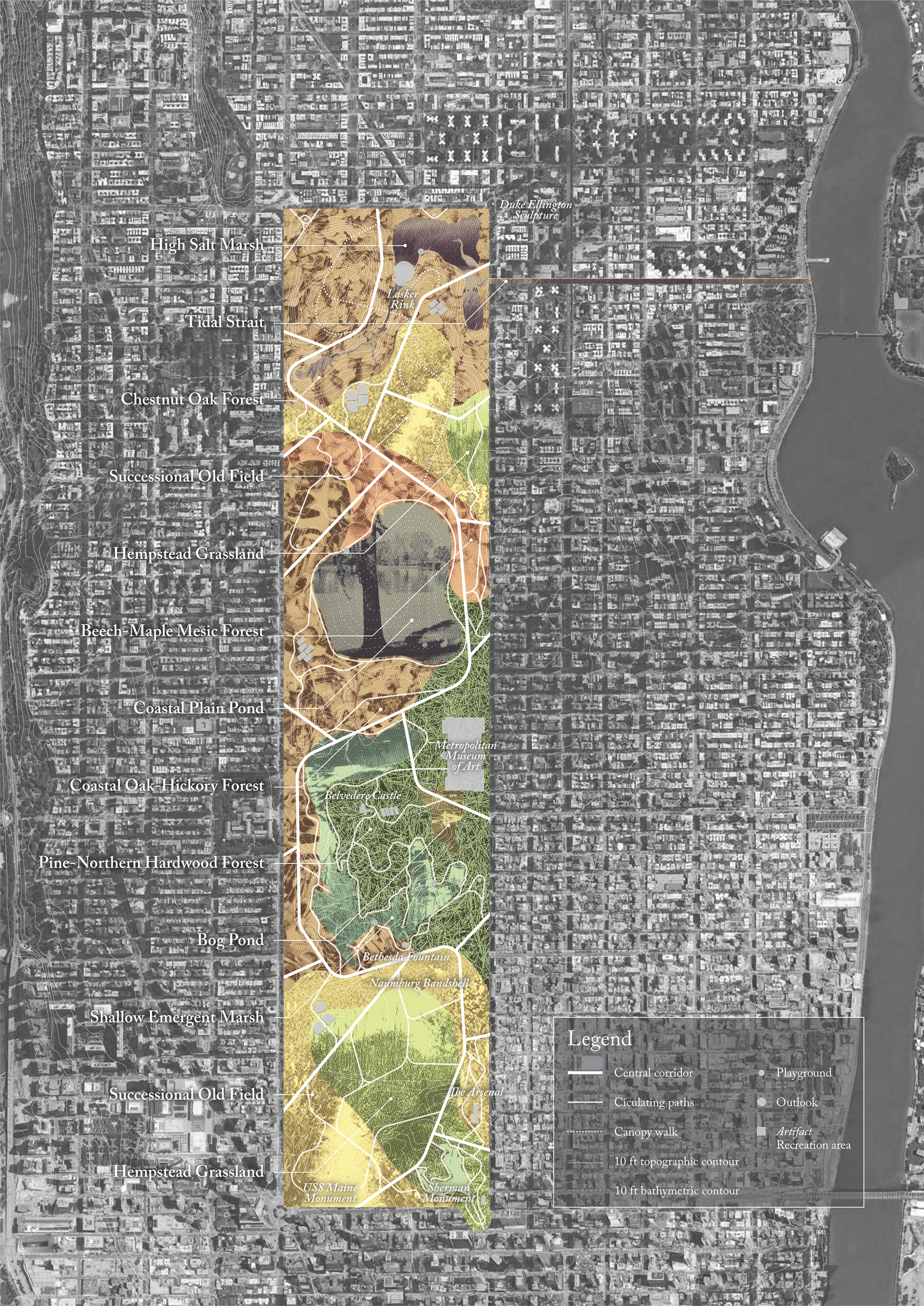
The new Central Park plan with circulation, ecosystems, and artifacts, those structures that have survived from the twentieth=century park and been subsumed by the new nature. The ecological communities selected for this project are based on the research of the Wildlife Conservation Society's Manahatta Project, which draws its definitions from Ecological Communities of New York State (Edinger, et al., 2014).
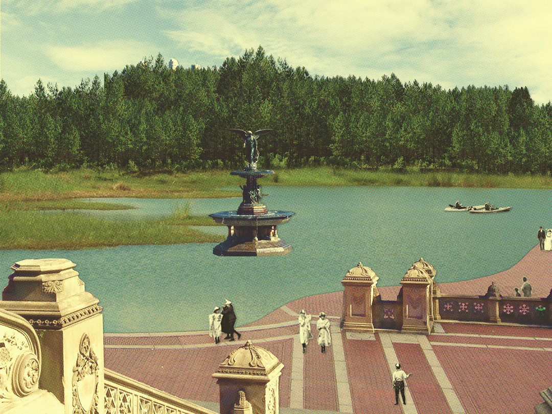
A recut Bethesda Terrace overlooking the marsh with pine forest in the distance
Historical maps and oral histories have revealed that the original urban grid sat beside “a pine woods, several ponds, and a chain of sand hills.” This multi-level, heavily planted dune system is now just a single, sparsely grassed dune just over twenty feet deep at its narrowest point. By methodically relocating homes closest to the bay (and thus most at-risk) into vacant portions of the historic district, space can be made to rebuild a robust dune system that will serve as natural protection against the sea. Native plantings, including woody maritime forest species, will help stabilize the system, offer crucial bird habitat, and create a dynamic landscape for exploration by visitors. Access to this resilient,
yet fragile landscape will be offered by storm-resilient boardwalks modelled after dune fencing. Six boardwalk paths will travel across the dunes and align with the existing urban grid. An alternate, interdunal path will wind its way north to south, passing underneath the orthogonal paths and connecting the park to the historic railyards and marina.
yet fragile landscape will be offered by storm-resilient boardwalks modelled after dune fencing. Six boardwalk paths will travel across the dunes and align with the existing urban grid. An alternate, interdunal path will wind its way north to south, passing underneath the orthogonal paths and connecting the park to the historic railyards and marina.
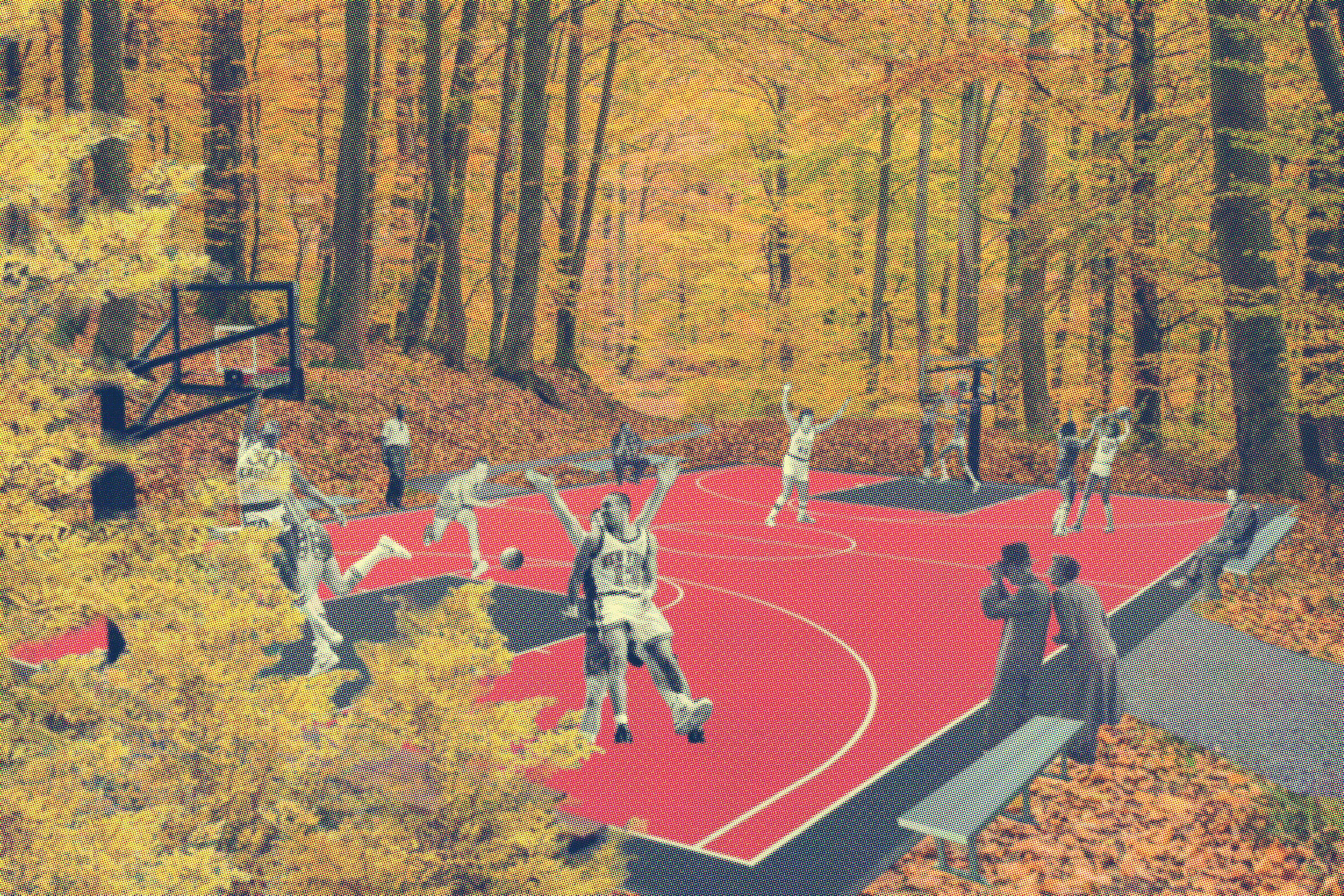
Embedded basketball court (Image by Colin Chadderton)

Aerial imagining of the park from Central Park East
The primary experience of the coastal park will be by way of elevated boardwalks, ensuring isolated disturbance of the dune landscape. The walls of the boardwalk are modelled on dune fencing, a nod to the pervasive fences throughout the historic district and an opportunity to encourage sand deposition. The central boardwalk, following from the city’s central avenue, extends out over the bay as a lookout. Wax myrtle trees line the early portions of this path, an oceanside continuation of the parade of crape myrtles that occupy the avenue’s planted median.

Section through the Grand Army Grassland at the southeastern corner of the park
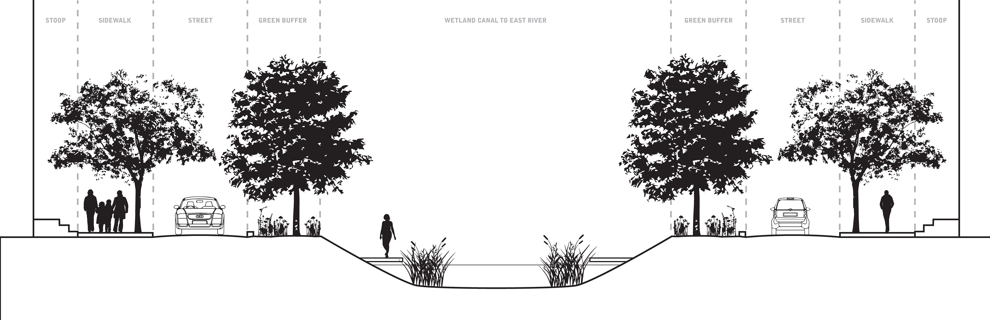
Section through the Upper East Side Canal that connects the park's hydrological network to the East River